Visiting NYC? Find events, attractions, deals, and more at nyctourism.com
The Official Website of the City of New York

September 2, 2016
Video available at: http://youtu.be/h1j4ilMd6uk
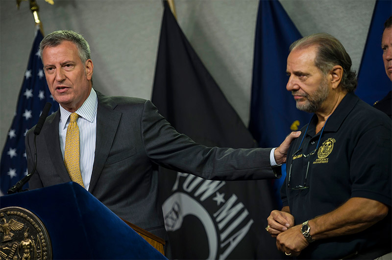
I want to thank my colleagues from City government who are here. You will hear from some of them. I also want to thank and acknowledge Liam Kavanagh from the Parks Department; Vincent Sapienza from DEP; Mitch Stripling from the Department of Health, Emergency Operations Division; Amy Peterson who is running our Build It Back program – director of Housing and Recovery; Tim Hogan from Department of Buildings; Chief Gerald Nelson, Vice President for Public Safety at NYCHA – all here with us. And thank you. And it’s an example of the fact that all City agencies are coordinating at this point with OEM taking the lead creating that coordination and that preparation again because there are several elements to this storm that we’re very, very concerned about.
Now, Hermine is currently in South Georgia. It is forecast too northeast near North Carolina coast by 2 am Saturday. Then, by 2 am Sunday the storm will be well off shore of Virginia and slowly tracking north towards Long Island. It will then – and this is one of the things we’re very concerned about – at that point it is projected to stall and remain off shore as a very strong storm through Wednesday morning. Now, that is a unusual situation – for such a large storm to stall and remain in place and have a real direct impact on New York City and Long Island – all the surrounding areas for such a long period of time, that’s unusual and that’s one of the things that’s causing us some real concern. We know that this is a changing situation. We don’t have all the facts yet of what to expect in terms of this weekend and beyond. We do know for sure we will feel very serious effects from this storm. So, although we’re not in a position yet to describe exactly what [inaudible], we know for sure we’re going to feel this storm strongly.
Now, coastal areas should be particularly concerned. Coastal flooding and heavy rain and strong winds are expected from late Saturday all the way through Wednesday. So, I want everyone to understand from Saturday – second-half of Saturday all through Sunday, Monday, Tuesday, Wednesday expect– in coastal areas – flooding, heavy rain, strong winds. We are going to look at a series of things that we may have to do as the storm develops to protect New Yorkers. I want to say in advance if the wind situation develops negatively we are considering bridge restrictions in some parts of the City. We have not made that decision yet. We have to get closer to this situation, but I want New Yorkers, particularly motorists, to keep watching in case bridge restrictions are declared.
Now, the particular concern – the number one concern – in terms of safety is rip tides right now. And I want people to understand this is a very unusual situation. According to the National Weather Service, we could see some of the most intense rip tides, literally, in 10 or 15 years. This could be some of the strongest and most dangerous rip tides. The phrase used by the weather service in the briefing I was just on was extremely dangerous rip tides. I want all New Yorkers to understand that it is not appropriate in this kind of situation – and this will start in earnest on Sunday – it is not appropriate to go into the water when you’re dealing with these kinds of rip tides. They are extremely strong. Once the rip tide grabs you, you cannot get out in many, many cases. So, some people are tempted during extreme weather to go and look. If you want to go look that’s one thing. Do not go in the water. It will be very dangerous. It will be unusually dangerous. It is not even going to be like some of the rip tides we experienced with lesser storms. These again, will be some of the strongest rip tides we’ve seen in over a decade. Now, we will be closing our City beaches on Sunday; meaning that people can go on the beach, but not in the water. So, we’ll be closing beaches for swimming on Sunday for sure – we’re announcing that now no swimming at our City beaches, Sunday. We will likely be closing the beaches for swimming on Monday and Tuesday as well, but we’ll make those announcements as we get closer and we see how the storm develops. If anyone has plans for Sunday, recognize there’s a very strong chance they will be disrupted, but under no condition should any New Yorker be swimming at a City beach on Sunday.
Now, we do not, at this moment, believe Hermine will become hurricane strength or anything close to what we experienced with Sandy a few years ago. We can say we learned some very powerful and painful lessons from Sandy and we’ve made a number of changes to the way we prepare for this kind of situation. We have a much stronger emergency preparedness apparatus in place. The situation room here at OEM has been activated, coordinating with the federal government, state government and our private partners as well. 30-plus City agencies are mobilized, working together. And there’s a whole host of issues that could come up in this situation – obviously, flooding, downed trees – trees coming down is a danger onto themselves, but can also knock down power lines. So, all the agencies stand ready to address these issues quickly. The City’s flash flood emergency plan has been activated to help mitigate potential flooding. Outreach teams will be working to protect the health safety of all new Yorkers, particularly those who are homeless or who need shelter for any reason. So, the City is prepared, but as we always talk about in these situations every New York also has to be prepared themselves. You can be assured your City government is in a ready stance right now to deal with this crisis, but all New Yorkers have to get ready as well.
So, a couple of key points: one, prepare a go-bag. If you live, particularly in coastal areas, you may need to leave your home quickly and you can go on the City’s website to get suggestions about what to have in that go-bag so you’re ready to move quickly. Second, prepare for flooding, if you’re in a flood susceptible area. And Joe Esposito will go over the specific neighborhoods that we expect to be particularly vulnerable. Things that you can do: you can keep the kind of materials around that will help protect your home. A lot of people who live in coastal areas are very familiar with these realities – plywood, plastic sheeting, lumber; sandbags all the things that will help protect your home. If you don’t have them already this is a good time to get them. And make sure that anything that might turn into a projectile in heavy winds – loose objects, lightweight objects that are outside are secured or brought inside the house. Next, prepare for power outages. The City and our partners in the utilities have a better job in recent years of getting ahead of power outages and limiting their impact. But they still are often the case when you have this kind of situation, so prepare for them. Charge cellphone batteries, turn your refrigerator to colder settings so it keeps your food cooler longer if the power goes out. As always, check on friends, check on neighbors, check on relatives especially check on seniors, check on anyone with a serious medical condition that you know to make sure that they are safe and they have what they need. And we do expect high wind conditions. I’m going to say the commonsense thing to do – if the winds really start to pick up get inside, do not go driving, do not go walking, do not go jogging – get inside if the winds become severe. Not only can you be in danger or your car be in danger in that situation, but again, you could find a projectile flying at you from something that is not secured and could be very dangerous.
As I mentioned, it is crucial to constantly keep in touch with the news, keep in touch with the updates to know what is going on. We’re going to be updating the restrictions. I hope we can give you more positive reports, but we have seen some storms get better and lesser as they go along. We’ve also seen storms take a sudden turn for the worse, so we need people to be vigilant and stay alert and stay updated. You can do that, obviously, through the news media, but also you can do that through 3-1-1 or via our website, nyc.gov. And if you want to get regular updates through Notify NYC you can sign up. Again, either through 3-1-1 or nyc.gov or you can follow us at the Twitter handle @NotifyNYC.
I have a few words in Spanish before I bring up my colleagues.
[Mayor de Blasio speaks in Spanish]
With that, I want you to hear from our OEM Commissioner Joe Esposito.
Commissioner Joseph Esposito, Office of Emergency Management: Thank you, Mr. Mayor. As the Mayor said we have been tracking this storm for over a week now. Hurricane season starts June 1st goes to the end of November and as a result we have been constant contact with the National Weather Service regarding this. This one we have been tracking since before it was even named the storm. As a result of the information we are getting we’ve done a number of things as the Mayor has articulated. We’ve also put in our flash flood plan which alerts the DEP, Sanitation, and DOT to go out clear catch basins especially in those areas where they tend to flood. So they are doing that actively. We’ve activated out down tree task force. We’ve had them on alert. We know that in weather like this we’ll have some trees down that will block roadways, create dangerous situations, and give us possibly minor power outages in areas where they are fed by overhead lines. So, we have them on alert. Our dewatering task force is on alert. That brings generators and [inaudible] to dewater streets in impassable locations. They’ll be able to go out there and get us back to normal as soon as possible. We’ve prepositioned equipment around the City; generators and pumps, light towers, things of that nature in case there are power outages or large flooding. We’ve been in touch with our healthcare facilities making sure that those [inaudible] are able to hunker down and get through this event. So, hospitals, senior centers things of that nature we have notified them. I think it is important to note that the Buildings Department has put a no-work order in. That will start tomorrow until this is over. So, the cranes are secured in a position that will withstand winds of over 70 miles an hour. So, that is starting tomorrow at 3 pm. The areas that we’re really concerned about – I mean the folks that live out there – they know it. I want to go over it just to make sure. Coastal areas that are at risk in Brooklyn – it’s Coney Island, Garrison beach – no surprise there. Out in Queens, the Rockaways, parts of Raw Channel, Howard beach – again, these areas experience floods under normal conditions, so we would think under these conditions you might get a little extra. Staten Island – Midland Beach, Oakland Beach, the areas around Father Capodanno Boulevard. And it’s even possible that the Bronx, Throgs Neck and Edgewater could be experiencing some of these floods. We’re going to make sure they’re extra prepared. Again, as the Mayor said Notify NYC that’s our system, we send out messages to all your mobile devices, even to your house phones, so if you don’t have it signed up for it, it takes two minutes to sign up for it. I would really encourage you to do that. Thank you.
Mayor: Thank, Joe. And now Chief Ed Mulane of the NYPD.
Chief Ed Mulane, NYPD: Good morning, the NYPD at the beginning of the hurricane season inventoried all our hurricane assets. We assessed them for accessibility and serviceability, and we’re ready to go. We have assets pre-staged in the Rockaway, Coney Island, on the East side of Staten Island. There’s other events going on in the city citywide that we’re monitoring. We’ve been in contact with the organizers of the Electric Zoo on Randall’s Island, also a Brazilian festival in Manhattan. Should there need be, there’s a large police footprint at each of these events if we need to somehow adjust times, dates, cancellations, we’d be prepared to do it. At this point there seems to be no reason to do that. They’re not concerned with the rain. They seem to be a little bit concerned with the wind. We’ll have to monitor that as the storm progresses.
Mayor: Thank you very much. Chief of the Department of the FDNY, Jim Leonard.
Chief of Department Jim Leonard, FDNY: Good afternoon, we continue to monitor this situation very closely with the Mayor’s Office and our partners in all the partner agencies you see up here. We are well prepared for any contingencies. We’ve activated our storm activation plan. We are in a planning stage right now to support all of those functions – search and rescue, provide emergency medical services, also down tree task force, pump operations. Any type of emergency that we will work with we are prepared to implement. We’re making – we’re evaluating now to see where they’re going to ramp up. As the storm progresses, we will make that decisions.
Mayor: Thank you very much, Chief. Now First Deputy Commissioner of the Sanitation Department Dennis Diggins.
First Deputy Commissioner Dennis Diggins, Sanitation Department: Thank you, Mr. Mayor. Good morning. The sanitation department as Commissioner Esposito stated will be covering catch basins as a part of flash flood programs. We’ll also be monitoring for downed trees. We’ve increased our staffing across the weekend. We’ll also be increasing our staffing at the special events – at the J’Ouvert just to make sure that with all of the downed trees possibility along Eastern Parkway we’ll have people out there to make sure that that will be unimpeded. We’ve got our supervisors out there monitoring and coordinating with Parks and OEM on the downed tree protocol and also monitoring our low lying areas for any possible flooding.
Mayor: Thank you very much. Finally I want you to hear from our Transportation Commissioner, Polly Trottenberg. Hold on, I’m going to get you a little extra height – oh, there is no extra height coming out. You’re going to –
Commissioner Polly Trottenberg, Department of Transportation: That is a bummer.
Mayor: Use your tiptoes.
Commissioner Trottenberg: I will miss the extra height. As the mayor mentioned from DOT’s point of view, we will be particularly focused on some of those wind questions when we have sustained wind speeds of over 40 mph that’s when we start to look at potential bridge closures. We’ll be coordinating with the MTA and the Port Authority on that. We’re also working with our contractors to make sure that all the construction sites around the city are secure. We’ll also be coordinating with our state and local partners and our traffic coordination center to be sure we’re looking at roadway incidents, bridge incidents as the storm approaches and also working with DEP and Sanitation on catch basins on the roadways to reduce flooding.
Mayor: Okay, we’re going to do questions about the storm specifically. Any questions based on this briefing? Any concerns?
Question: Mr. Mayor is there any chance that J’Ouvert and the West Indian Day parade might be cancelled as a result of the weather?
Mayor: Not based on what we know now. We’re going to be looking very carefully at the situation. As Joe Esposito was saying during our briefing earlier, we’ve seen very rainy conditions previously particularly at the parade and still the parade went on and a lot of people showed up. So based on what we know now, we will continue, but that’s going to be something we watch very carefully. The biggest problems as you hear are in the coastal areas so given that the parade through Crown Heights – so it’s well away from the coastal area – it should be affected less. But we will be keeping a close eye on that.
Question: Any conversation with the governor about the MTA about possible damage to MTA property like during Sandy?
Mayor: We’ve been talking to the State and the MTA, right now we don’t see that kind of scenario as we would’ve seen for example with a bigger storm or a major winter storm like the blizzard. We’re going to constantly monitor that though. If we get to the point where we see any possibility, we’ll certainly coordinate the timing of that. I don’t think the issues affect the MTA so much. I think when we talk about potential wind situations that are dangerous that has much more to do with our roads. One possibility is bridge restrictions if the winds really do become more dangerous. Yes, Dave?
Question: Mayor, two things, what changed because it seemed that last night, early this morning this wasn’t something we were going to have to worry about? It seems as if things have changed fairly significantly here. What changed? And also this is Labor Day Weekend. I think you had some plan. What were your plans, and I take it they have changed?
Mayor: I’ll tell you, I didn’t have any particularly elaborate plans, but I’ll certainly be happy to address them. Let me stay on the question of what changed. This is – as with every storm – you have to watch it hour by hour to understand what’s happening. So in some ways the deeper fears we had of an ever increasing storm that has not been realized so far, but we’re going to what to make sure that doesn’t happen. What is different – and the National Weather Service really emphasized this earlier – is the phenomenon of the storm coming up the coast and then stalling really for four days. That is very unusual. That’s why the rip current situation is going to be extremely dangerous and unusually dangerous, and the expert we were talking about this with at the National Weather Service said literally – I said when was the last time we saw rip tides this dangerous, he said it’s at least 10 or 15 years that they would be this intense and this sustained. That’s why we have to be very clear. Do not even put your foot in the water on Sunday and most likely for several days thereafter. We’ll constantly update people, but the fact that the storm is going to stall and create these extremely dangerous rip tides, that’s what different here. Dave, I did not have any particular plans except to be a part of the parade on Monday – looking forward to that even if it’s raining – and otherwise I’ll be here.
Yes, Marcia?
Question: Mr. Mayor what’s your biggest concern with the storm coming? Is it power outages, is it rip tides, is it flooding, and what do you want to tell New Yorkers in terms of how to prepare for what’s really their last weekend of the summer and they were hoping to have good weather?
Mayor: Marcia, it’s really, really sad that people are looking forward to a long weekend and it will certainly be compromised by this weather, but the number one thing I want to say to New Yorkers is the rip tides are extremely dangerous. This is my number one message. You know, we’re worried about flooding for sure. We’re worried about downed power lines and those can be very dangerous. But what I can guarantee you based on the projection of the National Weather Service is that there will be unusually dangerous riptides. No one should assume that they can handle these kinds of riptides, so if you go in the water you are putting your life in danger. It’s as simple as that. I say that to people going to the beach. I say it to surfers. Don’t even think about it. It’s going to be unusually dangerous, so that’s where – if you’re talking about potential loss of life – that’s my number one concern. We’re going to be out there aggressively. Parks Department and NYPD telling anyone who goes to the beach – including surfers – don’t do it. But beyond that Marcia it’s all the things we’re so used to when we have a storm – potential flooding, downed power lines, loss of power. We’re going to be working on all of those as well.
Mayor: Any other questions on the storm? Rich?
Question: So you’re going to be telling people not to go in or you’re going to be enforcing it, making sure they don’t go in, grabbing them and saying you’re not going in there?
Mayor: We – first of all – we always have a lot of beaches. We’ll have all the signs up, all the warning flags, all of that, and all enforcement will be out there telling people in a very direct, powerful way not to go in. We have not yet gotten to the question of whether we would forcibly stop someone from going in, but I think the NYPD and our parks Department folks are very good at getting their point across. I think anyone who talks to one of them will get the message that they just shouldn’t go in, and I think people will listen to that from our law enforcement personnel. In the same vein, if – and this is only an if – if we got to an evacuation situation anywhere that would be very forceful. That’s going to be – and this is one of the key lessons we learned from Sandy – if we say evacuate that we’re going to enforce with extreme purpose. We’re going to then have NYPD and other agencies going door to door and telling people this is not a matter of choice. That’s if we get to an evacuation situation. We are not there yet, but we will make our presence felt on the beaches for sure.
Question: Can people still go on the beach itself?
Mayor: Yes, Marcia. People can go on the beaches. Let’s be clear – we’re not changing Saturday, tomorrow. Beaches are open and you can swim tomorrow. On Sunday, beaches are open in terms of you can be on the sand, but we’re not allowing people to go in the water. I think based on what we know now that same rule will cover Monday and Tuesday. We’re not there yet, but we strongly believe we’re going to end up saying that both Monday and Tuesday as well you should not go in the water. But yes, people can walk on the beach, look at the power of Mother Nature, don’t even think about going in the water.
Any other questions on this storm?
I’ll finish by saying the obvious. We’re going to keep you regularly updated. You’re going to see the face of Joe Esposito a lot in the next few days. One thing I want to emphasize, keep listening for these updates. We’d like to be able to tell you at some point that the situation gets better, but there’s sometimes when the situation gets worse so it’s very important to stay updated. Everyone – all New Yorkers – need to be vigilant all the way to Wednesday because this one’s going to hang around for a while. Okay?
Thanks, everyone.
pressoffice@cityhall.nyc.gov
(212) 788-2958