
 Department of City Planning311Search all NYC.gov websites


Staten Island North Shore - Land Use & Transportation Study
Introduction
The Department of City Planning and the Economic Development Corporation are pleased to announce the release of North Shore 2030: Improving and Reconnecting the North Shore’s Unique and Historic Assets, the culmination of a collaborative two-year effort among City and State agencies, over 200 local experts – residents, business leaders and civic stakeholders - to craft a vision for the North Shore of Staten Island. The final report details long-term recommendations necessary to meet the 2030 Vision that will guide public and private investment and land use decisions over the next 20 years.
It was critical to all North Shore stakeholders for the city to identify short-term projects where the city and other agencies could focus efforts to advance the community’s 2030 Vision. To that end, the North Shore 2030 Action Agenda highlights the city’s new short-term commitments and the on-going work of the agencies in the borough’s North Shore neighborhoods.
Download by Chapter:
![]() Chapter 1: The North Shore Context
Chapter 1: The North Shore Context
The North Shore Land Use and Transportation Study was initiated at the request of Mayor Bloomberg’s Staten Island Growth Management Task Force as a response to the call for government to coordinate its efforts and comprehensively plan for the future of this five-mile long stretch of working waterfronts and historic communities. This Chapter describes the study area, the North Shore’s key assets, challenges, opportunities and the issues prioritized through the public engagement process.
![]() Chapter 2: Capitalizing on the North Shore’s Assets
Chapter 2: Capitalizing on the North Shore’s Assets
This Chapter identifies four overall strategies for revitalizing and reconnecting the North Shore’s key assets – its waterfront, historic streets, neighborhood centers, and the former railroad right-of-way – so that they better serve residents, businesses, and visitors over the next 20 years.
![]() Chapter 3: Applying the Strategies – Neighborhood Opportunity Areas
Chapter 3: Applying the Strategies – Neighborhood Opportunity Areas
North Shore 2030 presents an ambitious vision for improving and reconnecting the North Shore’s historic assets over the next 20 years. This chapter applies the four strategies to opportunity areas identified in: St. George, New Brighton, West Brighton, Port Richmond, Mariners Harbor-Arlington, and Jersey Street.
![]() Chapter 4: Implementation and Coordination
Chapter 4: Implementation and Coordination
The realization of this 20-year vision will require the participation and diligent oversight of a multitude of stakeholders. The final report is designed to provide clear priorities to all of those who will ultimately implement the proposed vision for the North Shore — local and regional agencies, developers, property owners, civic leaders, local elected officials and both current and future residents. The final report includes a full list of recommendations, and the North Shore 2030 Action Agenda outlines the City’s new short term commitments and ongoing initiatives.
The North Shore has been defined by its major assets – the Kill Van Kull waterfront, deep-rooted neighborhoods and town centers, historic streets, and the former North Shore railroad right-of-way. North Shore 2030 aims to reconnect those assets and unlock the North Shore’s potential through the four strategies described below.
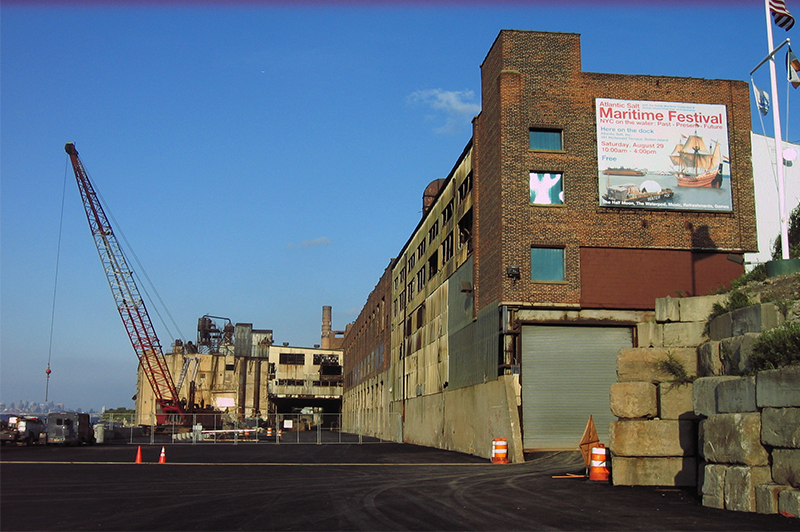
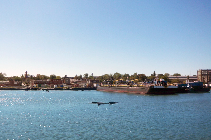
Asset: Kill Van Kull Waterfront
Create Quality Jobs and Workplaces
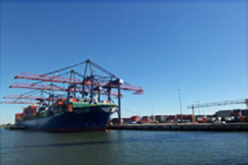
- Strengthen the maritime industry
- Target appropriate areas for expansion and identify priority shoreline infrastructure improvements
- Facilitate maritime development by continuing to work with state agencies to improve the permitting process
- Work with education and local development partners to locate a maritime training facility
- Support and grow industries and services
- Encourage use of underutilized historic buildings
- Work with industrial businesses to strengthen performance standards
Reconnect People with the Working Waterfront
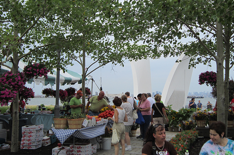
- Improve existing and create new public waterfront parks
- North Shore Esplanade
- Snug Harbor
- Faber Park<
- Former Blissenbach Marina
- Arlington and Mariners Marsh
- Richmond Terrace Wetlands (Van Pelt/Van Name waterfront)
- Evaluate use of street ends and transparent fencing for maritime overlooks
- Coordinate with Community Board 1’s efforts to designate a North Shore multi-purpose pathway
Asset: Neighborhood Centers
Support and Create Neighborhood Choices
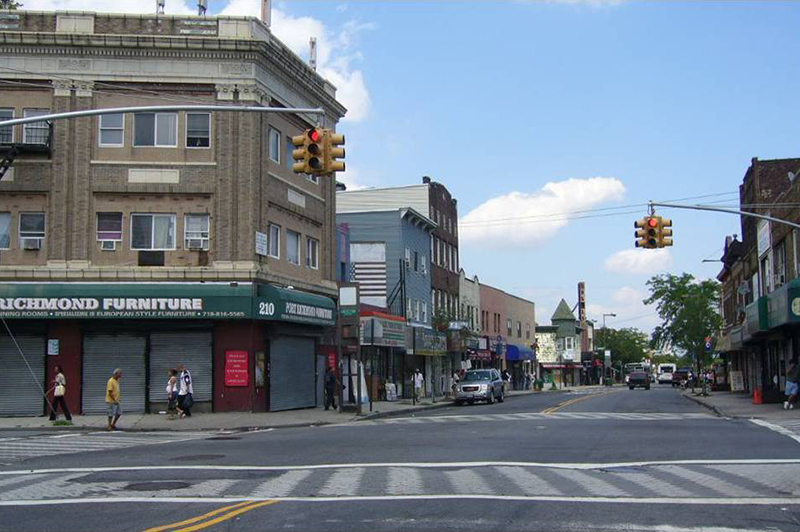
- Create destinations at strategic locations, celebrating and reusing historic buildings and working with local arts and cultural organizations to activate spaces and attract visitors
- Provide a more diverse mix of local retail and services with easy access to adjacent communities by recruiting and helping to site needed businesses such as grocery stores, restaurants, and clothing stores, and by improving parking options
- Strengthen neighborhood character and housing options by reviewing current zoning to ensure that it reflects mixed-use, pedestrian-oriented character of historic centers and encourages appropriately scaled residential development
- Protect neighborhood fabric by rezoning areas to reflect existing neighborhood character
- Support remediation of brownfield sites by providing incentives for appropriate redevelopment
- Leverage new development to improve sewer infrastructure, roads, and transit service in existing neighborhoods
Assets: Historic Street Grid and North Shore Railroad Right-of-Way
Improve Connections and Mobility
By targeting and coordinating improvements along the North Shore railroad right-of-way and key corridors, the following recommendations are designed to improve access to jobs and retail services, shorten travel times, support transit service and create a safer pedestrian environment.
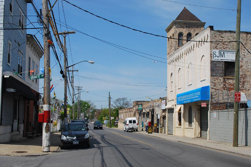
- Strengthen east-west vehicular connections
- Strategically widen Richmond Terrace to provide turn lanes and sidewalks where possible
- Make key intersection improvements to accommodate traffic and increase safety
- Explore the installation of medians on Forest Avenue, where appropriate, to prevent illegal left turns
- Increase safe pedestrian and bicycle connections
- Upgrade sidewalks, bicycle lanes, and pedestrian crossings
- Improve streetscape conditions along retail corridors,
- Support North Shore greenway efforts with a pedestrian and bicycle loop
- Bolster the existing transit network
 Transit Network
 - Incorporate the recommendations for improved transit options from MTA New York City Transit’s North Shore Alternatives Analysis
- Use signal prioritization to improve bus traffic flow on the most heavily used routes
- Develop underutilized sites near future transit hubs with park-and-rides and expanded residential and commercial uses
- Coordinate improvements with Working West Shore 2030’s transit recommendations
- Expand business opportunities along the railroad right-of-way
- Expand freight rail service on the western end of the right-of-way
- Relocate at-grade portions of the right-of-way to remove barriers from maritime job expansion
North Shore 2030 presents an ambitious vision for improving and reconnecting the North Shore’s historic assets over the next 20 years. This chapter applies the four strategies to opportunity areas identified in: St. George, New Brighton, West Brighton, Port Richmond, Mariners Harbor-Arlington, and Jersey Street.
North Shore 2030 lays out a twenty-year vision for a diverse, thriving and connected waterfront community. North Shore 2030's implementation is closely tied to regional and state planning efforts, and multi-agency coordination will be essential to the success of all initiatives. However, a significant amount of infrastructure investment will likely be made by the private sector as strategic sites are developed. This document provides clarity and guidance to residents, developers, and property owners – helping to ensure a coordinated network of improvements.
Below are long-term recommendations and the short-term work plan the City has committed to achieving over the next three years.
![]() Full list of 20-year Recommendations
Full list of 20-year Recommendations
A full list of recommendations, critical first steps, and agencies involved.
![]() North Shore 2030 Action Agenda
North Shore 2030 Action Agenda
This list includes new short-term commitments and the on-going work of the agencies in neighborhoods throughout the North Shore. This document identifies the lead agencies responsible for advancing progress and the targeted deadlines for completion. It will be used by the Mayor’s Staten Island Growth Management Task Force to track the progress of North Shore 2030.
Please check back here regularly for project updates.