
 Department of City Planning311Search all NYC.gov websites


Staten Island West Shore - Land Use & Transportation Study
The West Shore Land Use and Transportation study, managed by the Department of City Planning and the Economic Development Corporation, was recommended by the Mayor’s Staten Island Growth Management Task Force. The Task Force consists of the Borough President, all three City Council Members, City Commissioners, and local civic representatives. This study is an effort to provide a comprehensive framework to guide public and private actions and investment decisions on Staten Island’s West Shore over the next 20 years and beyond.
The West Shore has been the subject of several rezonings in the Charleston area that allowed retail and senior housing development. However, these rezonings raised community concerns that continued development would conflict with the existing limited infrastructure.
While the West Shore is home to historic neighborhoods and manufacturing uses, it is still without infrastructure to serve the needs of business and residents. There are areas without roads and many homes are still on septic systems. The community has raised concerns that on-going development pressures may conflict with providing jobs, preserving wetlands and open spaces and providing better access to parks and the waterfront. Task Force members requested a comprehensive review of future land uses and infrastructure needs for the West Shore, rather than piecemeal rezonings.
The study will bring together city and state agencies to provide suggestions on future infrastructure needs and to coordinate potential recommendations, including the NYC Department of Transportation, NY State Department of Transportation, the Metropolitan Transit Authority and the Port Authority of New York and New Jersey.
The goal of the study is to develop a community-supported framework, including short-term priority action items, for Staten Island’s West Shore that:
- Prioritizes job creation
- Identifies critical road and transit improvements
- Strengthens neighborhoods through improved
transportation, better services, and housing choices - Provides parks and open space and makes sure they are accessible


Study Area
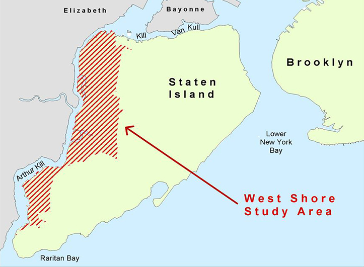
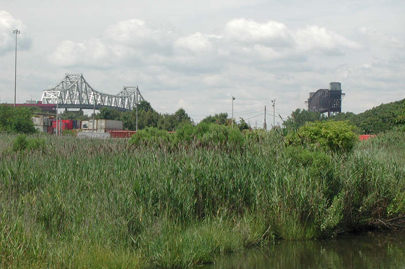
Running the length of the Arthur Kill, Staten Island's West Shore encompasses an area of approximately 6,300 acres, including the future Freshkills Park. The study area covers 11 ½ square miles, equivalent in size to ½ of Manhattan. The study area represents 20% of the borough’s land area and is home to the communities of Travis and Charleston. In addition, there are many areas that are located within the 100-year floodplain and large areas of wetlands and other environmentally sensitive areas.
The West Shore was historically the location of many industrial uses. However, while most of the area is still zoned for manufacturing uses, many of these jobs have left the city. Today, only 20% of the land area is still used for industrial purposes.
Due to this industrial history, the study area is left with several challenges:
- Many vacant sites are brownfields and will require costly environmental remediation.
- There remains a lack of basic infrastructure – both roads and sewer.
- The limited population on the West Shore means limited local demand for retail and services.
- There is minimal public transit.
- In addition, where residential uses do exist on the West Shore, there are often conflicts with surrounding manufacturing uses.
Pressure to develop on the West Shore is expected to accelerate in the coming decades as a consequence of natural population growth on the island, the shortage of alternative development locations, and proposed or completed infrastructure investments, including the replacement of the Goethals Bridge and the completed Arthur Kill Lift Bridge.
A number of studies have been completed or are under way that impact the West Shore. This study will build upon those recommendations and coordinate efforts to craft an action plan for moving forward. These studies include:
- NYC North Shore Land Use & Transportation Study (on-going)
- MTA North Shore Rail Right-of-Way Alternatives Analysis (on-going)
- SI EDC West Shore Light Rail Plan
- Goethals Bridge Study
- Freshkills Park Master Plan
- Charleston Roads Transportation Study
- West Shore Greenways Study
Additional information and West Shore research materials are available at www.nycedc.com/westshore.
May 2010 Open Houses
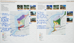
Based on intensive public engagement and working partnerships with City and State agencies beginning in 2008, City Planning and the Economic Development Corporation crafted a framework for discussion. Three public meetings throughout the West Shore were held in May 2010 to present the draft framework, get feedback, and establish priorities for implementation. Participants at the meetings were broken into discussion groups. The groups, after discussing the proposal in detail, identified key priority actions that would be necessary to achieve a Working West Shore. Following is a summary of their suggested priority action items for implementation:
Quality Jobs
- Craft an infrastructure and incentive package to attract employers to the West Shore, targeting job creation in the Bloomfield/Teleport area.
- Streamline the permitting process to provide a more business-friendly environment.
Road Improvements
- Short-term improvements
- Provide synchronized lights
- Install sidewalks
- Make minor street improvements at Forest Avenue and Goethals Road North to relieve truck/local traffic conflicts
- Widen Travis Avenue
- Build Englewood Avenue
- Widen Arthur Kill Road at the new MTA bus depot in Charleston
- Widen the remainder of Arthur Kill Road throughout the study area
- Provide exclusive truck ramps from the Goethals Bridge to industrial job centers
- Extend Forest Avenue
- Provide continuous West Shore Expressway service roads
Transit Improvements
- Short-term improvements
- o Reroute existing bus lines to provide better connections between existing neighborhoods and local job/shopping destinations (not just the State Island Ferry)
- Encourage ridership by providing safer, passenger-friendly bus stops with sidewalks and seating
- Create a multi-modal, regional network which connects local buses, express buses, and rail
- Provide more park and rides
- Relocate the Richmond Valley SIR station to Page Avenue
- Provide a dedicated, express bus lane on the West Shore Expressway
Waterfront Improvements and Access
- Short-term improvements
- Clearly identify existing waterfront access points (signage, website)
- Coordinate planning for the Arthur Kill with New Jersey agencies
- Clean up the waterfront and the water for public access and maritime job creation
- Activate the waterfront with diverse uses (parks, retail, housing)
- Provide continuous public access along the Charleston waterfront
Vibrant Centers/Destinations
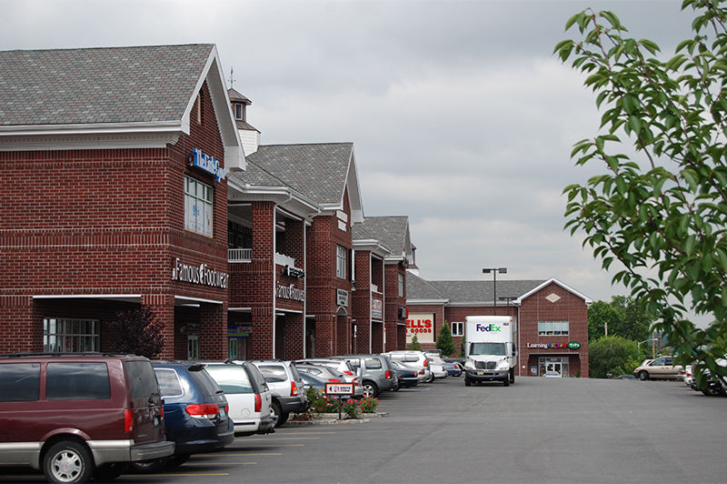
- Encourage additional retail and office uses to bolster Bloomfield/Teleport as a job center
- Encourage destination retail and entertainment on Forest Avenue, in Rossville, and in Charleston
- Provide diverse housing options with close access to transit and services for seniors and young adults
![]() View the May 2010 Open House Presentation
View the May 2010 Open House Presentation
![]() View the detailed notes from the discussion groups.
View the detailed notes from the discussion groups.
2008 Open House and Workshops
In 2008, the team held eight public open houses and workshops in West Shore neighborhoods to better understand the community’s needs and desires for their neighborhoods for the next 20 years. These public meetings helped to identify potential future land uses and infrastructure needed to address their concerns, and the ideas were incorporated into the draft framework presented in May 2010.
A public open house was held in March 2008 to kick-off the study. ![]() View the Public Open House Presentation.
View the Public Open House Presentation.
The study area was divided into four areas based on land uses and geography. The following presentations were used at public workshops held in their respective neighborhoods.
![]() View Zone 1 Arlington/Mariners Harbor Existing Conditions
View Zone 1 Arlington/Mariners Harbor Existing Conditions![]() View Zone 2 Bloomfield/Teleport Existing Conditions
View Zone 2 Bloomfield/Teleport Existing Conditions![]() View Zone 3 Travis/Freshkills Park Existing Conditions
View Zone 3 Travis/Freshkills Park Existing Conditions![]() View Zone 4 Charleston/Tottenville Existing Conditions
View Zone 4 Charleston/Tottenville Existing Conditions
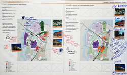
In order to determine the level of community support for future land uses and infrastructure needs, the workshops involved planning exercises in each of the West Shore neighborhoods. Playing cards were provided to community members noting a wide range of possible uses from large manufacturing, large retail buildings, small office buildings to different types of residential densities from single-family homes to apartments buildings. Public participants were asked to select appropriate land uses for several locations on maps of the West Shore to identify how the area may look in 2030. These maps were used to inform the project team in generating possible future scenarios for analyzing infrastructure needs.
A more detailed Existing Conditions Report and Market Analysis are available at www.nycedc.com/westshore.
Comprised of civic organizations, elected officials, and public agencies, the West Shore Study Advisory Committee has played an important role in informing the city throughout the study. The committee is comprised of stakeholders with unique perspectives on transportation, environmental, waterfront, residential and business issues. In addition to informing the city of local concerns, the Advisory Committee also assists in outreach efforts to ensure their membership and the community-at-large is aware of public meetings and opportunities to engage in the West Shore planning efforts.
The following is a list of organizations and agencies represented on the Committee:
- Office of Staten Island Borough President James P. Molinaro
- Office of City Council Member Deborah Rose
- Office of City Council Member James S. Oddo
- Office of City Council Member Vincent Ignizio
- SI Community Boards 1, 2 and 3
- American Institute of Architects, Staten Island Chapter
- Arlington Civic Association
- Building Industry Association of New York
- Charleston Civic Association
- College of Staten Island
- Con Edison
- Friends of Clay Pit Ponds Preserve
- Friends of Mariners Marsh
- Greenbelt Conservancy
- Mariners Harbor Civic Association
- Mariners Marsh Conservancy
- National Grid
- Staten Island Chamber of Commerce
- Staten Island Economic Development Corporation
- Staten Island Taxpayers Association
- Travis Civic Association
- VISY Paper/Pratt Industries
- Woodbrooks Estates HOA
- New York City Department of Design and Construction
- New York City Department of Environmental Protection
- New York City Department of Parks & Recreation
- New York City Department of Transportation
- New York State Department of Transportation
- New York State Department of Environmental Conservation
- New York State Department of Parks & Historic Preservation
- Metropolitan Transportation Authority, New York City Transit
- Port Authority of New York and New Jersey