
 Department of City Planning311Search all NYC.gov websites


Special Purpose Districts: Bronx
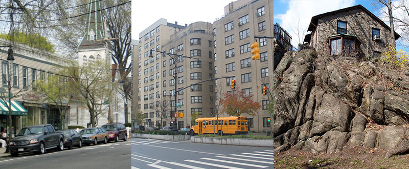

The Special City Island District (CD), encompassing an entire island in Long Island Sound, was adopted to preserve its nautical heritage and low-rise residential character, as well as the “village” quality of its commercial center on City Island Avenue. Regulations encourage the traditional building form of one or two stories of residences above ground floor stores in the village center, restrict the size and illumination of business signs, and establish landscaping and screening requirements for parking lots. New residential developments on large waterfront lots are required to provide a publicly accessible sitting area next to the shoreline. The only commercial and manufacturing uses permitted are those that reflect the island’s nautical flavor or serve the retail needs of residents and visitors.

The Special Grand Concourse District (C), extending almost the entire length of the boulevard from East 151st Street to Mosholu Parkway, was created to protect the distinctive art deco composition and scale of the apartment buildings that line this wide thoroughfare. The district establishes bulk and design regulations and limits commercial uses to specific locations. The district consists of a Residential Preservation Area and three commercial areas where retail uses do not conflict with the district’s traditional residential character.
The Special Harlem River Waterfront District (HRW) supports the revitalization of this underutilized area in the South Bronx into a vibrant, mixed use, mixed-income neighborhood while retaining viable light industry. Building heights and massing are modified along the Harlem River to promote orderly waterfront development. Bulk regulations encourage a varied skyline with waterfront views by requiring tall, slender towers surrounded by open space and public access areas, in accordance with the Waterfront Access Plan. There is a framework for mixed use development to ensure a full range of uses along the waterfront; each square foot of retail space must be matched with an equal amount of residential, community facility, office or hotel use, and at least 20 percent of each building must contain active uses at the ground floor. Affordable housing is available through the Inclusionary Housing designated areas Program.
The Special Hunts Point District (HP) in the South Bronx is adjacent to the Hunt’s Point Food Market, the city’s primary wholesale food distribution center. The district strengthens the expanding food industry sector and creates an area of high-performance industrial and commercial uses between the stable Hunts Point residential area and the heavy industrial areas. The two parts of the district—the Residential Buffer Subdistrict and the Food Industry Subdistrict—provide buffers by prohibiting most new heavy industrial uses regardless of performance standards, unless compatible with food businesses. Use, enclosure and street tree planting regulations provide a buffer and transition between the market, industrial uses and residences, improve the appearance of the area, and also promote retail services. Certain community facilities are allowed as-of-right.

The Special Jerome Corridor District (J), encompassing a two-mile stretch of Jerome Avenue in the southwest Bronx, was established as part of the Jerome Avenue Neighborhood Plan to foster a vibrant mix of residential, commercial and community facility uses. The Special District regulations include provisions that respond to the challenges of building adjacent to the elevated rail line on Jerome Avenue, enable improved walkability between residential neighborhoods, and help facilitate development on irregularly shaped parcels. The Special District regulations also require developments in specified areas next to subway stations to work with the Metropolitan Transportation Authority to determine if an improved entrance on their site is needed.

The Special Mixed Use District (MX) was established in 1997 to encourage investment in, and enhance the vitality of, existing neighborhoods with mixed residential and industrial uses in close proximity and create expanded opportunities for new mixed use communities. New residential and non-residential uses (commercial, community facility and light industrial) can be developed as-of-right and be located side-by-side or within the same building. Pairing an M1 district with an R3 through R10 district (e.g. M1-2/R6) ensures a balanced variety of uses.
Residential uses are generally subject to the bulk controls of the governing residence district; commercial, industrial and community facility uses are subject to the M1 district bulk controls, except that community facilities are subject to residential FAR limits. Most light industrial uses are permitted in each MX district as-of-right, others are subject to restrictions and Use Group 18 uses are excluded altogether, except for small breweries.
Special Mixed Use Districts in the Bronx:
| MX-1: | Port Morris Maps: 6a, 6b Effective Date: 12/10/97 |
| MX-7: | Morrisania Maps: 3d, 6c Effective Date: 8/19/03 |
| MX-13: | Lower Concourse Map: 6a Effective Date: 6/30/09 |
| MX-14: | Third Avenue/Tremont Avenue Maps: 3c, 3d Effective Date: 10/13/10 |
| MX-17: | Hunts Point Map: 6c Effective Date: 3/22/18 |
| MX-18: | Mott Haven Map: 6c Effective Date: 10/17/19 |

The purpose of the Special Natural Area District (NA) is to guide new development and site alterations in areas endowed with unique natural characteristics, including forests, rock outcrops, steep slopes, creeks and a variety of botanic and aquatic environments. In the four Special Natural Areas, the City Planning Commission reviews proposals for new development, enlargements and site alterations to maximize protection of natural features. Natural features are protected by limiting modifications in topography, by preserving tree, plant and marine life, and natural water courses, and by encouraging clustered development.
Special Natural Area Districts in the Bronx:
The Special Planned Community Preservation District (PC) designation protects the unique character of communities that have been planned and developed as a unit. Those communities characteristically have large landscaped open spaces and a superior relationship of buildings, open spaces, commercial uses, and pedestrian and vehicular circulation. No demolition, new development, enlargement or alteration of landscaping or topography is permitted within the district except by special permit of the City Planning Commission. Preservation districts have been mapped in Parkchester in the Bronx.