
 Landmarks Preservation Commission311Search all NYC.gov websites


Press Release
For Immediate Release: December 12, 2019
Contact: lpcpressoffice@lpc.nyc.gov, 212-669-7938
LPC Releases Story Map Highlighting 50 Years of Designations Associated with NYC's Abolitionist History
New York City played an important role in the effort to abolish slavery nationwide, and to assist those seeking to escape it.
On the 400th anniversary of the arrival of the first enslaved Africans to America, LPC wanted to bring greater awareness to the city's abolitionist history by telling the story through designated landmarks that embody it.
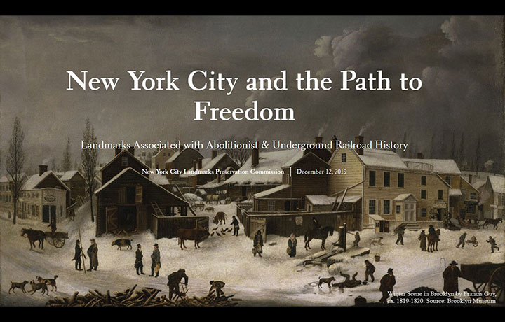
New York – Today, the New York City Landmarks Preservation Commission (LPC) launched an interactive story map called New York City and the Path to Freedom. New York City played an important role in the effort to abolish slavery nationwide, and to assist those seeking to escape it. In observation of the 400th anniversary of the arrival of the first enslaved Africans to America, LPC wanted to bring greater awareness to the city's abolitionist history by telling the story through designated landmarks that embody it. Through narrative text, images, maps, and multimedia content, the public can learn the important history behind these buildings.
"The designated landmarks highlighted in this story map form an impressive collection of physical spaces that help tell the story of abolition and the Underground Railroad in New York City," said Landmarks Preservation Commission Chair Sarah Carroll. "As we reflect on New York City's legacy of both slavery and abolitionist activities, I hope New Yorkers will be inspired by the stories of abolitionists who took great personal risks to house enslaved individuals and to publicly advocate for abolition."
"New Yorkers will now have an interactive guide to discovering our city's contribution and significance to the Abolitionist movement," said Deputy Mayor of Housing and Economic Development Vicki Been. "I want to commend the Landmarks Preservation Commission for moving beyond a plaque to developing the Story Map, which gives viewers a deeper understanding of the importance of history and place."
Organized by borough, LPC's story map documents designated buildings associated with the multiple ways people and institutions engaged with the anti-slavery movement before the Civil War, whether through political and religious activism or by housing freedom seekers as part of Underground Railroad networks. The map also highlights landmarks associated with New York's free black communities established in the 19th century in the period before nationwide emancipation.
In sharing the story of abolitionist activities, the story map is also frank about the reality of slavery in New York City and its ties to the South. Slavery was present in New York City from its earliest European settlement, with the first enslaved people brought to New Amsterdam in 1626, and total emancipation was not achieved until 1827.
Brooklyn
Brooklyn had a rich abolitionist history before the Civil War, and important buildings with documented associations to the Underground Railroad remain standing today. In the early 19th century, Brooklyn's economy relied heavily on the storage and export of agricultural products shipped from the Southern slave-holding states, yet its waterfront location and large population of free African-Americans made it a hub for abolitionist activity. The story map highlights nine New York City landmarks associated with the Underground Railroad, including residences where enslaved individuals were housed, religious institutions that offered them aid, and a rural African-American community that provided refuge and the opportunity for landownership. LPC also mapped a three-mile walking tour stopping at these nine landmarks that together tell the inspirational story of Brooklyn's role in fighting for freedom for enslaved African Americans.
- Fulton Ferry Landing, Fulton Ferry Historic District - During the 1850s, this landing's ferry service brought crowds of people to Brooklyn on Sundays to hear Henry Ward Beecher's fiery anti-slavery sermons at nearby Plymouth Church on Orange Street.
- Plymouth Church, Brooklyn Heights Historic District - This was the church of well-known abolitionist minister Henry Ward Beecher and was considered the "Grand Central Station" of the Underground Railroad in Brooklyn.
- 70 Willow Street, Brooklyn Heights Historic District - This Greek Revival-style house, built in 1839, is associated with the important African-American abolitionist James Pennington.
- 86 Pierrepont Street, Brooklyn Heights Historic District - From 1844 to 1865 this house belonged to the prominent abolitionists Lewis and Sarah Tappan.
- Church of the Pilgrims, Brooklyn Heights Historic District - One of the founding members of this Congregational church was Henry C. Bowen, Lewis Tappan's son-in-law, who was active in abolitionist causes, and Richard Salter Storrs, the congregation's first and most renowned minister, promoted anti-slavery reforms in his preaching.
- Friends Meeting House – This individual landmark built for the Society of Friends (Quakers) had connections to the abolitionist movement and may have been part of the Underground Railroad.
- First Free Congregational Church (now Polytechnic Institute Building) – This individual landmark is the home of the oldest African-American congregation in Brooklyn and was home to significant abolitionist activities and may have been part of the Underground Railroad.
- Lafayette Avenue Presbyterian Church, Fort Greene Historic District - This building may have served as a station on the Underground Railroad. The church's first pastor, abolitionist Theodore Ledyard Cuyler, promoted the end of slavery.
- Houses on Hunterfly Road (Weeksville) - The free African-American village of Weeksville was established before the Civil War by 1838, when several African Americans purchased lots in Brooklyn's 9th ward and built wood frame houses.
Manhattan
Before the Civil War, Manhattan was home to more than 10,000 free African-American residents and a dedicated community of abolitionists from all races and social classes. With its population concentrated below 34th Street, anti-slavery and Underground Railroad activities took place across Lower Manhattan. This story map highlights two buildings with documented abolitionist history have been designated as landmarks, as well as the historical site of Seneca Village, a free African-American community located within an area of today's Central Park.
- Lamartine Place Historic District - Lamartine Place has a strong connection to the abolitionist movement in Manhattan, to the Underground Railroad, and to the 1863 draft riots.
- 2 White Street House – This individual landmark was home to the African-American abolitionist Theodore S. Wright, who along with Peter Williams Jr. and Samuel Cornish, was a leader of the anti-slavery and anti-colonization movements in New York City.
- Seneca Village, Central Park - Seneca Village was New York City's first significant community of free African-American property owners.
Queens
Until slavery was abolished in New York in 1827, Long Island, including Queens County, had one of the largest populations of enslaved persons in the North. Pockets of abolitionist activity nonetheless thrived, particularly in the progressive Quaker community of Flushing. This story map highlights two designated landmarks in Queens associated with the Underground Railroad, including a farmhouse owned by a prominent family of anti-slavery activists, and the local Friends Meeting House, which had advocated for abolition since the early 18th century.
- Friends Meeting House (known as the Old Quaker Meeting House) – This individual landmark is the oldest house of worship in New York City and one of the oldest in the country. Abolitionist Quakers including William Burling, John Farmer, John Woolman, Matthew Franklin, and Elias Hicks preached against slavery in this meeting house.
- Bowne House – This individual landmark was built by John Bowne, a prominent Quaker and advocate of religious freedom. It was home to nine generations of the Bowne and Parsons Families, members of which played instrumental roles in the anti-slavery activism during the late 18th century.
Staten Island
Although enslaved individuals accounted for 10 to 23 percent of the population of Staten Island during the colonial period, in the first half of the 19th century, an increasing number of free African Americans chose to settle on Staten Island because land was available and inexpensive. Progressive individuals and abolitionists also moved to Staten Island around this time, forming an enclave known as Elliottville. This story map highlights four designated landmarks associated with this history on Staten Island, including residences of prominent figures in the local abolition movement, and the free African-American community of Sandy Ground.
- 69 Delafield Place House – This individual landmark belonged to Dr. Samuel Mackenzie Elliott, an active and outspoken abolitionist. Elliott's house has been documented as a stop along the Underground Railroad and included a notably large cellar with a fireplace for cooking that may have been used by those seeking refuge.
- George William and Anna Curtis House – This individual landmark was the home of notable reformists and abolitionists George William and Anna Curtis.
- 565 and 569 Bloomingdale Road Cottages and Rossville AME Zion Church (Sandy Ground) - These individual landmarks were part of Sandy Ground, a thriving community for free African Americans on Staten Island.
About the Landmarks Preservation Commission (LPC)
The Landmarks Preservation Commission is the mayoral agency responsible for protecting and preserving New York City's architecturally, historically and culturally significant buildings and sites. Since its creation in 1965, LPC has granted landmark status to more than 37,000 buildings and sites, including 1,439 individual landmarks, 120 interior landmarks, 11 scenic landmarks, and 149 historic districts and extensions in all five boroughs. For more information, visit www.nyc.gov/landmarks and connect with us via www.facebook.com/NYCLandmarks and www.twitter.com/nyclandmarks.