
 Department of City Planning311Search all NYC.gov websites


Press Releases
For Immediate Release
November 4, 2021
Contacts:
Melissa Grace, Joe Marvilli – press@planning.nyc.gov (212) 720-3471
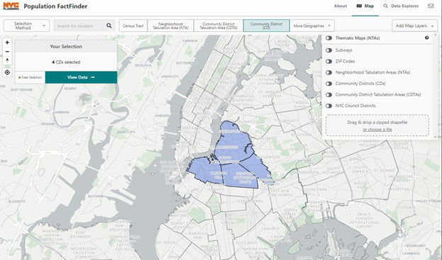
Population FactFinder Updated with 2020 Census Data
Key digital tool adds crucial statistics about New York’s 8.8 million-strong population
NEW YORK – Department of City Planning (DCP) Director Anita Laremont today announced the re-launch of Population FactFinder with details on the 8.8 million New Yorkers counted in the 2020 Census.
“The 2020 Census showed us that New York City is more populous and more diverse than ever, and DCP’s Population FactFinder makes the data, about who lives in our neighborhoods and the city as a whole, easily available to all of us as we plan for a more equitable city and a full recovery,” said DCP Director Anita Laremont.
As we work to recover from the COVID-19 pandemic, build affordable housing, and create jobs, this tool provides a simple way for the public to research and understand the diversity of neighborhoods across New York City.
The site provides a comprehensive look at the city’s population, including details about New York City neighborhoods such as age, race/Hispanic origin, and housing. Population FactFinder makes comparisons between 2010 and 2020 Censuses possible, showing change over time in an easy-to-read format. This distinguishes it from other demographic tools. Beyond new 2020 census blocks, census tracts, and Neighborhood Tabulation Areas, the tool now allows users to examine census data by Community District.
Population FactFinder continues to incorporate the rich array of socioeconomic data from the American Community Survey, now updated to 2020 Census geographies. It incorporates a new geography, called Community District Tabulation Areas (CDTAs), which closely matches Community District boundaries. This feature provides users with socioeconomic data that are otherwise unavailable at the Community District level. Read more about the updated geographies here.
With this update, every topic and map selection has its own unique URL, making it easy to save and share research with others. For example, the increase in Long Island City’s population can be shared with friends and colleagues directly.
This digital platform is one of many DCP has produced over the past several years as part of its commitment toward increased accessibility and transparency for the public through well-designed, open source, web-based tools.
Department of City Planning
The Department of City Planning (DCP) plans for the strategic growth and development of the City through ground-up planning with communities, the development of land use policies and zoning regulations applicable citywide, and its contribution to the preparation of the City’s 10-year Capital Strategy. DCP promotes housing production and affordability, fosters economic development and coordinated investments in infrastructure and services, and supports resilient, sustainable communities across the five boroughs for a more equitable New York City.
In addition, DCP supports the City Planning Commission in its annual review of approximately 450 land use applications for a variety of discretionary approvals. The Department also assists both government agencies and the public by advising on strategic and capital planning and providing policy analysis, technical assistance and data relating to housing, transportation, community facilities, demography, zoning, urban design, waterfront areas and public open space.