
 Department of City Planning311Search all NYC.gov websites


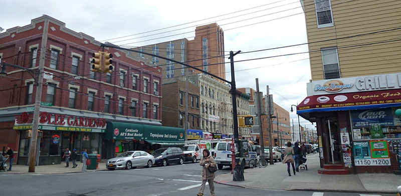
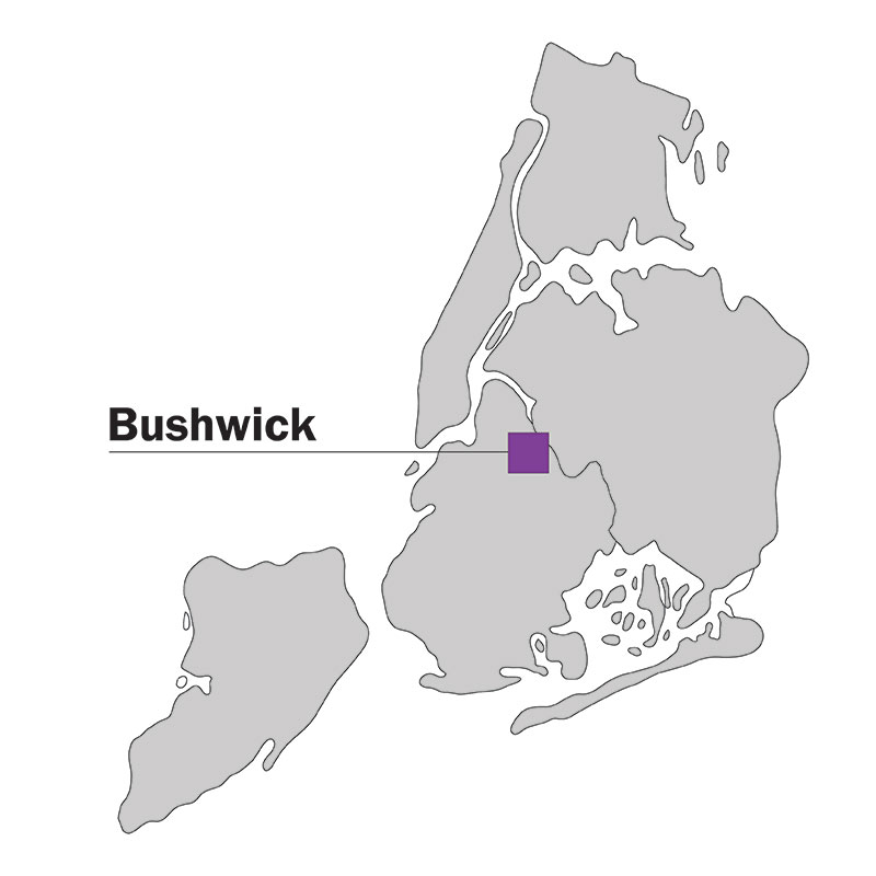
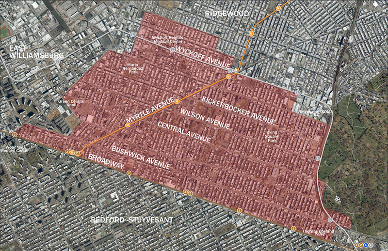
Bushwick
What is the Bushwick Neighborhood Plan?
The Bushwick Neighborhood Plan is a draft area-wide plan that is based on the collaborative planning process conducted by community residents, stakeholders, City Council Members Antonio Reynoso and Rafael Espinal, and City agencies to promote a thriving and inclusive neighborhood with strategies for affordable housing, economic development, community resources and land use and zoning changes.
The Bushwick Neighborhood Plan builds on the Bushwick Community Plan, a planning process spearheaded in 2014 by Brooklyn Community Board 4 jointly with Council Members Reynoso and Espinal in response to concerns about new out-of-character development and tenant displacement in the neighborhood. The Council Members invited residents to create a vision for Bushwick’s future at a series of visioning town hall meetings and zoning workshops in 2014-2016. This process identified priority issues, including: affordable housing, transportation, infrastructure, parks, neighborhood character, economic development, and public health and safety, as well as areas appropriate for preservation and for growth within the community. A Steering Committee of local stakeholders was established to delve deeper into the ideas shared by Bushwick residents and help design and lead the planning process.
In 2016, Sub-committees made up of local residents and stakeholders, Steering Committee and Community Board members, and City agency representatives, formed to gather input and develop recommendations around six focus areas:
- Housing;
- Open Space;
- Economic Development;
- Community Health and Resources;
- Transportation and Infrastructure;
- Land Use and Zoning;
From 2016 to 2018, the Steering Committee and Sub-committees led a robust series of community engagement activities, alongside City agencies, Council Members Reynoso and Espinal, and local organizations. In September 2018, the BCP Steering Committee released a report to advance the following goals:
- Be proactive and intentional about how and where development happens;
- Create affordable housing;
- Develop new tools to preserve existing affordable housing;
- Increase opportunities for small businesses to grow and locate in Bushwick;
- Work closely with City agencies to direct resources to the community for open space, infrastructure, transportation, and other neighborhood needs.
The Bushwick Neighborhood Plan reflects the community outreach conducted during this multi-year planning process and was informed by the objectives and strategies put forward in the BCP Steering Committee’s September 2018 report.
New York City is experiencing an unprecedented housing and affordability crisis as a result of an inability of new housing construction to keep pace with the demands of a growing population and workforce. Without a steady supply of new housing, renters in all neighborhoods will continue to feel the squeeze of a tightening housing market. To help keep New Yorkers in their homes, the City has dramatically increased resources for tenant protections and legal assistance and is making unprecedented investments in preserving existing affordable housing and constructing new affordable housing, with tools such as Mandatory Inclusionary Housing (“MIH”). MIH requires affordable housing as part of new development in areas that have been rezoned to promote new housing.
As part of this trend, Bushwick has seen rents rising quickly - almost twice as fast (60%) as the borough (38%) and citywide (32%) from 2000 to 2016. In addition, over half of Bushwick households are burdened by high housing costs, meaning they spend more than 30% of their income on housing (half of these households spend more than 50% of their income on rent). The housing market has responded to these rising rents with new buildings – permits for over 6,600 new housing units were constructed in Bushwick between 2000 and 2018.1
While the existing zoning in much of Bushwick allows new housing construction, it does not include requirements for affordable housing or distinguish between areas where more substantial development would be appropriate or inappropriate, such as along blocks with small rowhouses. As a result, Bushwick has seen the construction of much new housing in recent years and, while this helps ease the housing crunch, much of this construction has been market-rate and only limited affordable housing, primarily either on a few remaining City-owned sites, those controlled by mission-driven developers, or in areas rezoned with incentives for the inclusion of low-income housing. To accommodate increasing demand for housing in Bushwick, the Department of City Planning in coordination with other City agencies, has been working with community residents and stakeholders to identify areas for both growth with new affordable housing and preservation of existing built character.
1 Certificates of Occupancy for new construction in Community District 4, 2000-2018; NYC Department of Buildings records; DCP HEIP Division (March 2019)
Through a series of over 150 events, including sub-committee meetings, summits and workshops, the Department of City Planning (DCP), the Bushwick Community Plan Steering Committee, members of Community Board 4, and other local stakeholders, together have been working to refine the above shared goals into specific land use objectives to guide a long-term vision for the future of Bushwick.
The resulting DCP land use objectives, based on the agency’s analysis and on-going outreach and shared at Bushwick Community Plan meetings, recognize the area’s varied context and aim to meet multiple objectives while proactively planning for the neighborhood’s future.
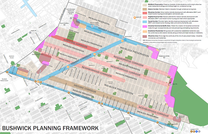
DCP’s land use objectives:
- Preserve neighborhood character of Bushwick’s side streets (i.e. mid-blocks) by establishing contextual zoning districts to limit height and maintain existing scale
- Allow for appropriate growth with permanently affordable housing, retail, and community facilities in appropriate locations on east-west avenues
- Promote higher density mixed-use development with permanently affordable housing close to transit
- Allow building envelope flexibility to respond to elevated train conditions and improve the pedestrian experience along elevated train corridors
- Reinforce job-generating uses (i.e. commercial, industrial, community facility) and enhance the vitality of industrial districts
- Encourage a mix of residential, commercial, and industrial uses to best respond to needs for both jobs and new housing, including affordable housing
The above land use and zoning objectives would be paired with strategies to create new affordable housing, in addition to the identification of critical neighborhood investments that would accommodate additional residential density. Alongside the development of this land use framework, the Department of Housing Preservation and Development (HPD) has worked closely with the BCP Steering Committee and other local stakeholders to develop a set of strategies to preserve existing affordable housing in the neighborhood, which are currently in progress. These strategies include efforts to finance and safeguard affordability, promote safe and healthy housing, and protect tenants. The map below represents a template for future development in Bushwick based on these land use objectives. Learn more about the comprehensive set of strategies that comprise the Bushwick Neighborhood Plan.
A more in-depth analysis of the existing land use and economic conditions in Bushwick that shaped the industrial areas framework can be viewed in the Bushwick Industrial Areas Analysis.
![]() Items accompanied by this symbol require the free Adobe Acrobat Reader.
Items accompanied by this symbol require the free Adobe Acrobat Reader.