
 Department of City Planning311Search all NYC.gov websites


Special Purpose Districts: Staten Island
The Special Bay Street Corridor District (BSC) was created to foster better connectivity between Staten Island’s civic core in St. George and the town center of Stapleton by promoting a more continuous, pedestrian friendly commercial street scape and create the opportunity for additional housing on the North Shore. The Special District allows for Physical Culture or Health Establishments to be permitted as-of-right, permits breweries within the Commercial District, and allows for the creation of second-story non-residential uses and office buildings to offer flexibility in the kinds of businesses and services that are permitted along the corridor. Height and density provisions allow for tailored building envelopes that respond to the neighborhood context by limiting density adjacent to lower density residential neighborhoods, and allowing greater height and density on larger sites closer to transit. Additional ground floor, façade articulation, and visual corridor regulations promote a more active streetscape. Special parking and loading provisions are intended to balance commercial and residential parking requirements and support the creation of locally-oriented commercial uses, jobs and services.
The Special Hillsides Preservation District (HS) guides development in the steep slope areas of Staten Island’s Serpentine Ridge, an area of approximately 1,900 acres in the northeastern part of the borough. The purpose of the district is to reduce hillside erosion, landslides and excessive stormwater runoff by preserving the area’s hilly terrain, trees and vegetation. The primary means of regulating development in the district is to control the amount of the lot that can be covered by a building. As the development site becomes steeper, permitted lot coverage decreases (although the permissible floor area remains the same). This may result in a taller building but less impact on steep slopes and natural features. There are special regulations for the removal of trees, grading of land, and construction of driveways and private roads.
The purpose of the Special Natural Area District (NA) is to guide new development and site alterations in areas endowed with unique natural characteristics, including forests, rock outcrops, steep slopes, creeks and a variety of botanic and aquatic environments. In the four Special Natural Areas, the City Planning Commission reviews proposals for new development, enlargements and site alterations to maximize protection of natural features. Natural features are protected by limiting modifications in topography, by preserving tree, plant and marine life, and natural water courses, and by encouraging clustered development.
Special Natural Area Districts in Staten Island:
| NA-1: | Emerson Hill, Dongan Hills, Todt Hill, Lighthouse Hill and the central wetlands Maps: 21b, 26a, 26b, 26c, 26d, 27a, 27b Effective Date: 12/19/74 |
| NA-3: | Shore Acres Area Map: 21d Effective Date: 12/1/77 |
The Special South Richmond Development District (SRD) was established in 1975 to guide the development of the southern part of Staten Island. At a time of rapid development, strict rules were adopted to manage growth in this area of more than 20 square miles and to ensure that the provision of public infrastructure kept pace with new development.
To avoid destruction of the natural and recreational resources that define the community, the district mandates tree preservation and planting requirements, controls changes to topography, and establishes special building height and setback limits, and designated open spaces (DOS) to be left in a natural state as part of an open space network that includes public parks and waterfront esplanades. To ensure that public school needs are addressed, the Chairperson of the City Planning Commission must certify that sufficient school capacity exists to accommodate a new residential development, except in a predominantly built-up area, before a building permit can be issued.

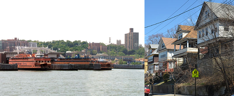
The Special St. George District (SG) was created to support a pedestrian-friendly business and residence district in a unique hillside waterfront community that is one of Staten Island’s oldest commercial neighborhoods. Adjacent to the Staten Island Ferry, the area is a major transit hub and the borough’s civic center. Special rules enhance designated commercial streets by requiring continuous ground floor commercial uses, with large windows and wider sidewalks. The configuration of towers is regulated in order to preserve views from upland areas to the waterfront. Vacant office buildings can now be more easily converted to residential use. Special parking and landscaping provisions are intended to provide a pleasing pedestrian experience.
The Special Stapleton District (SW), on the north shore of Staten Island, is part of a comprehensive plan to develop the former U.S. Navy homeport into a 12-acre waterfront esplanade with a mixed extension to the Stapleton town center. Special commercial district regulations provide for mixed buildings with ground floor retail uses, such as waterfront restaurants and other water-related uses, in a walkable neighborhood. Design controls, including street wall provisions and a low building height to frame the public park, respect the character and scale of the upland portions of Stapleton. To encourage similar development on key streets linking the town center to the waterfront, space used for non-residential uses on the ground floor of buildings containing residential uses will not count as floor area. Although not subject to waterfront design rules, pedestrian connections to the waterfront esplanade and unobstructed visual corridors are required at regular intervals as extensions of the streets of the Stapleton town center.